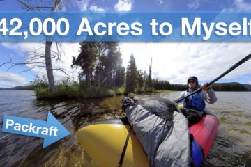
I have just finished editing a “highlights” video from the 30-day solo packrafting/hiking trip I did this past summer, so if you’re interested in seeing what that trip was like, please check it out.
I’m also working on a written trip report that includes maps, pictures, and a gear list (all posted here).
I’m also planning to make vlog-style videos of the trip, because the 54-minute long highlights video is only a small fraction of the footage I captured along the way, but video editing is extremely time consuming, so I’m not sure when I’ll be able to finish those.
Once again, all that stuff is posted permanently on this page.


20 Comments
Asger bohl · February 16, 2021 at 5:22 pm
What did you change on your skeena 120 from the one you sell to keep its weight at only 60 oz?
Matt (Admin) · February 16, 2021 at 7:54 pm
I didn’t change anything, I just weighed it without the seat.
richard voss · January 31, 2021 at 1:05 pm
Bruce :
Well done … thanks! This fully qualifies as wilderness adventure traveling (… i’ve been on a few 👍🙏)
Richard
Anders Jonsson · January 21, 2021 at 4:04 am
Nice and inspiring! It also make mi curious about what kind of cameragear you use on your trips? I would also be interested to know what kins of riggs other pacraftbuilders use for mounting cameras when you are not shooting with a drone. Would it be a thing to have in mind before starting to assemble a diy-pacraft?
Matt (Admin) · January 21, 2021 at 8:48 am
Thanks! I used a 360 camera on the end of my trekking pole to film the paddling – no drone or other rigging required. For more information, there’s a link to a complete gear list (including camera gear) in the post above.
thewwkayaker · January 1, 2021 at 6:37 pm
OK I goofed. I looked on google maps and have things upside down. I’ve paddled two sections of the Nimkish – the part below Woss via Woss River into Nimkish (that was the easy section). The part above and into Woss we entered via Davie River which, combined with the waterfalls made for a more advanced paddle.
So did you paddled the part after Woss? You finish at Nimkish lake but I use to climb up a ridiculously steep bank way up to a bridge on the fsr to avoid the flat paddle of the lake.
I’m intrigue though with the upper Nimkish now. Likely would be fine with a bike on a packraft for the most part to do all of the Nimkish river (skipping the falls for certain). I’ll have to read back on your trip and see what else I could add to make an interesting bike raft trip loop.
Sorry for getting my info mixed up.
Matt (Admin) · January 2, 2021 at 2:52 pm
Yep, I paddled below Woss as well (you can see my entry and exit points on the maps on write-up page). There’s almost no traffic on the roads parallel to the river, so any loop in the area would be good for bikerafting.
thewwkayaker · January 1, 2021 at 2:25 pm
Matt how did you like paddling the Nimkish River? I lived in Port McNeil for a year (many many moons ago) and it was one of my earlier rivers I explored. The upper part was easy but there was one tiny tiny canyon that had an interesting needle drop but at flood level was actually was nasty. The lower part as it comes into Woss has a cool waterfall to drop at lower water and during flood a weird wave. I know you didn’t paddle the lower part as you described you got out before hand but did you do the tiny canyon? How was the run down to where you got out? Also how did you enter the Nimkish – we used another feeder creek as I recall. I’m asking because you had gear with you in a pack raft so I’m curious to how you found the run.
Matt (Admin) · January 1, 2021 at 3:59 pm
Loved it! It’s a beautiful river. I paddled in from Vernon Lake via the Sebelhall River, which was nice, aside from the log jams. There’s a bridge over the Sebelhall, so maybe that’s where you started too. I did paddle a beautiful little canyon lower down, but walked around the boulders/ledge leading into it because with the low water level it looked a bit too sharp. I had to walk several short sections of the river where it widened out over gravel bars because of the low water level – August probably isn’t the best month to paddle the Nimpkish (bit it’s still mostly doable). I’m working on some more videos that will show more detail.
thewwkayaker · December 31, 2020 at 2:57 pm
Amazing! Loved it!
I was confused as to why that woman told you you couldn’t enter the lake via the river. If you stayed either on the river or below flood line of the river banks you have full right to do so (Canadian Navigable Act).
I have a similar tent (zpacks) – 3 person version though (2 dogs and a wife requires more space). Might get the 2 person as we sometimes travel separately.
I have a gossamer gear backpack instead of the zpacks backpack which is super comfy and only a tiny bit heavier.
I think I’ll work out some smaller loops to hike/paddle or bike/paddle out of your bigger adventure.
Matt are you still living on the island or are you in Smithers like your business says? Love the island. I’ve tried to get to Smithers 3 times and failed (long story) but one day – good backcountry skiing and mtn biking there! Always looking for new places to play.
Thanx again for sharing your adventure!
Matt (Admin) · December 31, 2020 at 3:51 pm
Thanks! I do indeed live in Smithers!
That river is probably one of just a few in Canada where that law doesn’t apply – the river is part of a First Nations treaty settlement area, and in the treaty’s fine print it does clearly say that the river is included in the private property. I wasn’t aware of it beforehand (it’s not marked on any of the maps I have), but I did confirm it afterwards. If someone was planning to do a similar route, I would recommend seeking permission in advance, or simply going straight from Alberni Inlet to Nahmint Lake via the Nahmint River valley to bypass that area entirely. There’s a big log jam in the Henderson River anyway, so it’s not an attractive route.
Len · December 23, 2020 at 5:38 pm
Yow. Amazing. Looking forward to the feature-length doc. Excellent work. What a trip.
Ruedi · November 20, 2020 at 12:03 pm
Dear Matt,
I’m deeply impressed by your trip – what an adventure! And your documentation is awesome, and very useful too. I admire the (huge amount) of work you’ve invested to make your dream become a reality, and to show us how beautiful it is out there in the nature. I really hope that some more people will be inspired to leave their comfort zone, and to go out and to see this by themselves. Life can be so beautiful. All the best to all of you, and kind regards
Ruedi from Oeko-Travel Org and Biber-Boote in Switzerland
Matt (Admin) · November 20, 2020 at 3:28 pm
Thanks, Ruedi! I hope someone will be inspired by me in the way that I was inspired by other people.
Melissa · November 6, 2020 at 1:50 pm
What an incredible journey and beautiful footage! You worked SO hard to do all this and the video is gorgeous. My 2 year old daughter likes to watch it and say, “Oh preeety”! Like one other commenter said, you did a crazy amount of hiking and cool shots holding the camera. Looking forward to the Vlog and going to go read your blog details because very interested for more info on where you were and what each day was like.
Matt (Admin) · November 7, 2020 at 12:16 pm
Haha, that is wonderful! Thanks 😀
Stuart Warren · November 5, 2020 at 10:05 pm
What at amazing trip. Looking forward to making my own raft and doing something similar.
Matt (Admin) · November 6, 2020 at 8:24 am
Fantastic! I was inspired by other people, so I hope my journey inspires others too!
KenS · November 6, 2020 at 9:19 am
What a great video. You skills at “seeing” the right thing to shoot are second to none. I love the close up shots of the moss, spider webs, ferns, pine boughs and the way you capture the light coming through the trees,. The panoramic vistas are breathtaking. Your “little planet” panorama of you traversing the rocky crag was scary and evoked my fear for you at that point. You did a lot of hiking carrying the camera pole! Great job! Great trip!
Matt (Admin) · November 7, 2020 at 9:19 am
Thanks, Ken!